The Adi Kailash route map shows the journey through the remote Himalayan region of Uttarakhand, where travellers move away from daily life into high-altitude landscapes.
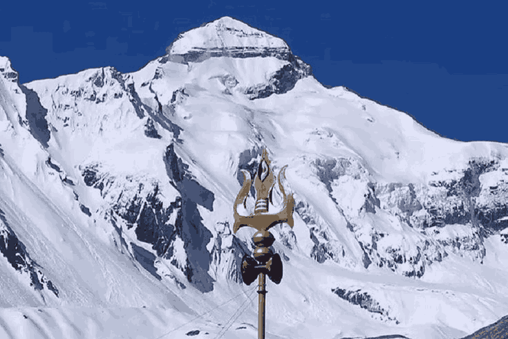
Adi Kailash, also known as “Little Kailash,” is located near the Indo-Tibet border at an altitude of about 6,191 metres. It is an important pilgrimage site for devotees of Lord Shiva and also attracts trekkers and travellers.
Compared to Mount Kailash in Tibet, the Adi Kailash route map is more accessible for Indian citizens as it does not require international travel or complex permits. This has increased its popularity in recent years.
However, the journey on the Adi Kailash route map is still difficult. It includes steep roads, river crossings, high altitude, and changing weather conditions. Proper planning and acclimatisation are necessary for a safe trip.
The route usually starts from Dharchula and passes through Tawaghat, Narayan Ashram, Gunji, and Nabhidhang before reaching the sacred region near Om Parvat. The Adi Kailash route map offers a mix of natural scenery, cultural villages, and spiritual significance.
Adi Kailash Route Map
The Adi Kailash route map follows a scenic and high-altitude route through the Pithoragarh district of Uttarakhand. Most travellers begin the journey from Dharchula and travel through Tawaghat, Narayan Ashram, Gunji, and Nabhidhang before reaching Adi Kailash and Om Parvat.
Day 1: Kathgodam / Tanakpur to Dharchula
Altitude: 915 m
Travel Time: 7–9 hours by road
The Adi Kailash journey usually starts from Kathgodam or Tanakpur railway station. Travellers reach Dharchula by shared jeep or bus via the Kali River valley. Dharchula is the main base point for permits, medical checks, and acclimatisation.
Day 2: Dharchula → Tawaghat → Narayan Ashram
Altitude: 2,438 m
Distance: Drive + 8 km trek
The road journey continues to Tawaghat, where trekking begins. The trail passes through forest areas and mountain paths before reaching Narayan Ashram, a peaceful stop with basic accommodation and meals.
Day 3: Narayan Ashram → Sirkha → Gaala
Altitude: Approx. 2,750 m
Trek Distance: 14 km
This section of the Adi Kailash route map includes forest trails, valleys, and traditional Himalayan villages. Gaala is an important trekking stop with views of the surrounding mountains.
Day 4: Gaala → Budhi → Gunji
Altitude: 3,073 m
Distance: 18 km
Some road sections toward Gunji are now motorable due to BRO road development projects. Gunji is one of the main villages on the Adi Kailash route map and has KMVN guest houses, ITBP check posts, and basic facilities.
Day 5: Gunji → Nabhidhang
Altitude: Approx. 3,640 m
Distance: 11 km
This day is mainly for acclimatisation before moving to higher altitude regions. Proper rest and hydration are important to avoid altitude sickness during the Adi Kailash Yatra.
Day 6: Nabhidhang → Om Parvati Lake → Adi Kailash Base
Altitude: Approx. 4,500 m
Distance: 10 km
This is the most important day of the Adi Kailash route map. Travellers visit Om Parvati Lake and continue toward the Adi Kailash base area. Clear weather offers excellent mountain views and photography opportunities.
Day 7–8: Adi Kailash Parikrama and Kalapani JCP
Altitude: 5,000+ m
Pilgrims perform the Adi Kailash Parikrama around the sacred peak. Many groups also visit Kalapani and the Joint Check Post (JCP), an important border area near the origin of the Kali River.
Day 9–10: Return Journey to Dharchula
Route: Gunji → Dharchula → Kathgodam / Tanakpur
The return follows the same Adi Kailash route map back to Dharchula. Most travellers continue onward to Kathgodam or Tanakpur for trains and buses.
How to Prepare — Practically and Physically
The Adi Kailash trek is graded moderate-to-difficult. You do not need to be an experienced mountaineer, but you do need to be honest with yourself about fitness. Three months of regular walking, cycling, or stair-climbing will make a meaningful difference to your experience.
Permits (2026)
Indian citizens need an Inner Line Permit (ILP) from the Sub-Divisional Magistrate office in Dharchula. Apply at least 2 days in advance or online via the Uttarakhand e-District portal. Carry multiple photocopies of your Aadhaar and the permit itself — checkposts are frequent.
What to Pack
Layered clothing is essential for the Adi Kailash route map journey because Adi Kailash temperature can change quickly during the trek. In lower valleys, temperatures may be around 25°C, while at higher camps they can drop below 0°C.
During the Adi Kailash trek, it is important to carry a down jacket, waterproof outer layer, thermal innerwear, and sturdy trekking boots already broken in. Also pack trekking poles, a sleeping bag rated to -10°C, and a headlamp with extra batteries for safety during night travel or emergencies.
Health & Safety
Consult a doctor before departure if you have any cardiovascular or respiratory conditions. Carry Diamox (acetazolamide) for altitude sickness prophylaxis — but discuss dosage with your doctor first. A basic first-aid kit, oral rehydration salts, and blister treatment are non-negotiable.
Connectivity
Mobile network disappears beyond Dharchula for most carriers. BSNL has the best (but still limited) coverage. Download offline maps on apps like Maps.me or OsmAnd before departure. Satellite communicators (like Garmin inReach) are worth hiring for solo trekkers.
Travel Responsibly
The Kali River area is environmentally sensitive, so avoid littering during the trek. Carry your waste with you and avoid single-use plastics. Some tour operators may also charge a ₹500 waste-management fee to help keep the Adi Kailash route clean.
Culture Along the Adi Kailash Route Map
The Adi Kailash route map passes through remote Himalayan villages in Uttarakhand with strong cultural and spiritual traditions. The region reflects a mix of Kumaoni Hindu culture, Tibetan Buddhist influence, and the heritage of the Shauka trading community.
Villages along the Adi Kailash route map feature traditional wooden houses, local temples, prayer flags, and small mountain settlements. Important stops such as Narayan Ashram, Gunji, and the area near Om Parvat are known for their religious importance and peaceful environment.
Travellers on the Adi Kailash route map can experience local customs, simple Himalayan lifestyles, traditional food, and the hospitality of border communities in the Kumaon region.
What the Adi Kailash Route Map Does Not Show
The Adi Kailash route map shows the path, roads, and trekking routes, but it cannot show the actual experience of the journey. Conditions such as high-altitude weather, silence in remote areas, and natural surroundings near Om Parvat are not visible on a map.
The Adi Kailash route map is useful for planning travel, including permits, packing, acclimatisation, and weather preparation. These details are important for safety and smooth travel.
However, travellers should be prepared for changing weather, altitude effects, and different on-ground conditions that may not match the map exactly.
Conclusion
Whatever draws you to the Adi Kailash route map — devotion, adventure, photography, or simply a feeling you are chasing — the journey has a way of giving you something far beyond expectations. More than just a trekking trail, the Adi Kailash route map leads travellers through sacred landscapes, remote Himalayan villages, and deeply spiritual experiences that remain unforgettable long after the journey ends. That, perhaps, is the true magic of the Adi Kailash pilgrimage route
.